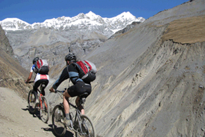
Highlight of the Trip
Jomsom, a modern town, is the ‘Thakali’ homeland. The Thakali people are of Tibetan origin but have their own language and customs. We fly to Jomsom from Pokhara and we will ride through a popular trekking trial which leads us to many different and most interesting villages from cultural and architectural points of view. The rocky track slowly descends to meet a paved road which takes us to the beautiful city of Pokhara on day 5.
Jomsom to Kalopani via Marpha, Tukuche, Kobang, Larjong and Kokhethanti.
The Thakali have established the tradition o`1`1Q546f hospitality to passing traders for centuries along the Thak Khola stretch of the Kali Gandaki between Jomson and Tatopani. The flagstone-lined village of Marpha is popular for apple farming. Tukuche at 2590m was once a meeting place for traders from Tibet. Overnight at guest house
Kalopani -Tatopani via Ghasa Rupse Chara and Dhana. The trail follows the Kali Gandaki valley. The river cuts a channel between the Annapurna 1 and Dhaulagiri peaks, thus, qualifying the Kali Gandaki valley for the title of the world's deepest gorge. We ride through Gasa at 2080m and one stage takes a precious route through a very steep and narrow section of the gorge to reach Dana at 1400m. This is where the difficult track branches off to Maurice Herzog's base camp, used for his historic ascent of Annapurna in 1950. Push and carry in some sections. The ride is mostly on a newly made wide gravel track/trekker's track.
Tatopani - Beni. Tato means 'hot' and Pani Means 'water', a name bestowed courtesy of the hot springs by the river. Tatopani is a popular destination for a shorter trek out of Pokhara. From Tato -pani, we cross the bridge to the eastern side of the Kali Gandaki (a major river) and shortly afterwards, the bridge over the Ghara Khola River. WE continue on the trail up to Ghorepani, continue south along the Kali Gandaki where the trail rises and falls through small villages. Less than an hour ride from quieter and far more attractive riverside village, Tiplyang (1040m) , the trail takes us to the bustling market town, Beni. Buses run along the east bank road to Baglung and on to Pokhara. The ride is mostly on newly made wide track/trekker's track
Beni to Sarangkot
After breakfast, we will follow the Kali Gandaki River and reach the Baglung Highway which will lead us to Naudanda where we will have lunch. We follow the dirt road to Sarangkot which is the number one view point in the Pokhara to enjoy the view of the Himalayas at sun rise and sun set and the Lake.
Sarangkot to Pokhara
Today, we ride mainly through a steep and narrow road to Pokhara. Make sure to check your brakes before you start for about a 90% down hill descent.


